
Wheelton Moor
Length
|
Estimated Duration
|
Difficulty
|
4.7 miles
|
4 hours
|
4
|
Max Elevation
|
Terrain Types
|
Smiley Rate (Caches/Distance)
|
759 feet
|
Poor Path / Track / Moorland
|
2.34
|
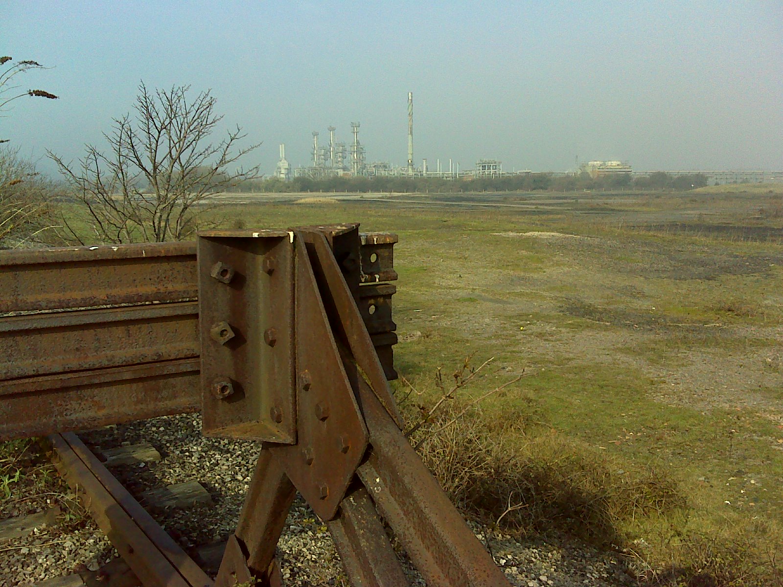
 After the blazing sun last weekend in Wales we knew we were going to be faced with less clement weather today.This coupled with the fact that the smallest crew member was still recovering from tonsillitis meant that a shorter walk was planned.I’ve had a mind to visit Wheelton Moor for some time as I had solved a puzzle cache in the area and wanted to pick it up (GC1WYDR).Another cache of note (The Mother Of All Caches) was also close by as were a few of Magna Defenders tougher hides.So with route planned (I lied and told the crew it was a three miler) and the geo-bus loaded we headed out early to hit the moors.
There is parking a plenty at the local cricket ground as well as in surrounding areas (PR6 8TF if you have a satnav) and a short walk past the café at the ground gives way to the entrance to White Coppice and the start of the public trails.

 The first of Magna’s hides saw me clambering down a river bank and then traversing along, under bridges, only to then have to stoop under a second bridge to find the cache.No wonder it rates 4.5 stars!The rest of the crew had decided not to follow and were shouting encouragement from above.From this point our route takes us to the Mother of all Caches (GC1TY0N).
We decided to brave climbing the hill in a direct approach rather than following the rough laid track that is the public footpath.It’s manageable but if the ground is wet my advice would be to stay to the footpath! The terrain was very steep and the going very uneven underfoot…something which would become a problem for one of the crew later on…
 Arriving at the cache site and the crew mates soon uncovered the cache.Nice and big this one with plenty of stuff in it.We took the obligatory photos and signed the log before moving on.For anyone interested in these mega big caches I can recommend Charnock Swarms ‘Kilo’ cache (GC2W1PJ) – super big!


 We had reached the summit now and planned to walk back on ourselves along the upper ridge, darting off to collect a few of Pop Up Pirates caches along the way.First up was Round The Ruins – Printworks.We left the comfort of the pathway and headed across the uneven surface of the moor again.The crew were barely visible in some of the long grasses and The Good Wench was making a habit of falling over (too much grog last night)!The views are great from up here but on a sunny day they would be spectacular.After finding the cache we decided again to cross the moorland rather than return to the path, as it was a more direct (i.e. shorter) route.Shorter doesn’t mean easier though!
It was getting a bit boggy in places and the ground more and more uneven.Then it happened.The Good Wench went over on her ankle and let out a scream.I cooed soothing words to her as she rolled around on her back like a beetle – things like, “it’s ok we are only 342 feet away from the next cache, you’ll be all right”.Given the expression on her face I knew I would be getting acquainted with the sofa tonight unless I switched into First Aider mode (yes I am actually before you ask). After a preliminary check for broken bones we concluded it was a bad sprain and with her ankle swelling up like a balloon we changed plans and headed for home asap.
We descended down the footpath, which was luckily only a few feet from where we were, and The Good Wench hobbled all the way down.We stopped to ‘rest’ in a few places… those places coincidentally were close to some caches so I darted off to grab them –well why not we were here weren’t we!
 As we approached the cricket ground again I wanted to take one more detour to get a cache that I had missed earlier.As we were about to go through the gate we spotted two dogs we recognised closely followed by the image of fellow cacher Schnuz.After exchanging pleasantries we walked down the track to grab our final for the day.By now The Good Wench has developed a kind of Quasimodo gait and frankly it’s getting a bit embarrassing being out with her –better get her home for some TLC…. No no not from me… I’ll ring her mum when we get back J.
As we drive home The Good Wench points out that I have forgotten to pick up the puzzle cache that I had laboured over solving (and one of the reasons for the trip today).Grrr….Guess she has the last laugh in the end. Like Arnie says though – I’ll be back! Happy caching.

…footnote.. if the café at the cricket ground is open they do a mean sausage, bacon and egg sarnie J

Mostyn
Length
|
Estimated Duration
|
Difficulty
|
3.1 miles
|
2 - 3 hours
|
2
|
Max Elevation
|
Terrain Types
|
Smiley Rate (Caches/Distance)
|
161 feet
|
Path / Track / Road
|
4.19
|
 An easy level walk around the causeway at Mostyn. Walk includes the Cob cache series planted by Team Marzipan (who are prolific in this area and have spent a lot of time inventing some good hides). If you are lucky you may find one of their caches and get to speak to them in person! We parked up near GC1E8EK which is the first cache in the series and at the entrance to the public foot path. We followed the route which take you along about a mile of causeway which offers some great views. The series has some neat hides for the kids and they are pretty easy to find. As we walk along the derelict Duke Of Lancaster comes into view.
  She is a railway steamer passenger ship that operated in Europe from 1956 to 1979, and is currently beached at Mostyn docks after being sold to Empirewise Ltd on 10 August 1979. Intention was to create a 'Fun Ship' but planning for a 300 bed hotel leisure centre didn't float... get it...float...ahh what the heck!
She had a short spell acting as a warehouse by its owners Solitaire Liverpool Ltd, a clothing company registered to the same address as Empirewise Ltd. It now stands idle with no plans to scrap or develop it. It is said though that whilst she is rusting on the outside the interior remains pretty good... but that could be Estate Agent speak!
 We turned a corner at the Lancaster and started to head for home. At the end of the pathway leading back to the car is a cache that has us worried. 'Don't fall in'.... hmm and there is a river. Past logs speak of life jackets etc... Oh well in for a penny and all that. We arrived at the cache site and pondered where it could be and then I spotted a likely loose stone in the river bank. Given my height it wasn't a big stretch to retrieve this but for some I could see how they have fallen in. A nice find to have given all the anticipation that had built up around it. We walk back towards the car down the main road bagging a few more of the Cob series along the way. TeamMarzipan put a great deal of effort into their hides, the containers are novel, the hiding places usually set within spectacular countryside and a few are just plain sneaky! Along with a Geocaching page that's full of descriptions and badges for completing things they are now a firm favorite to follow should we return to Wales one day. Go on you know you want to... go and find some plastic!
Point Of Ayr
Length
|
Estimated Duration
|
Difficulty
|
6.1 miles
|
2 - 3 hours
|
4
|
Max Elevation
|
Terrain Types
|
Smiley Rate (Caches/Distance)
|
391 feet
|
Path / Track / Road / Beach
|
0.82
|

 In Wales for a weekend visit to a caravan park so that The Good Wench could meet up with her friends from the Dibb (Disney web site) and one of the conditions was that I could go for a wander on my own. Setting off early on Saturday morning I had this route in mind as it picks up only a few caches along the way (about 5 or so) and I thought that it wouldn't peak the childrens interest enough to keep them going that sort of distance.
The first leg of the walk is a two mile jog up the beach front and it can get hard going as the sand is mostly soft. I had the whole beach to myself as far as the eye could see - fantastic, a real 'finding God moment' if you're inclined that way.

As I progressed though the fog rolled in which didn't detract from the walk but it did make bumping into a lighthouse a bit of a surprise.
One of the best caches along this route is the Land O'Sand earth cache. The view from the lookout point is, I'm sure on a clear day, spectacular but even today it is breath taking.
Continuing on and the route takes you to a remote cache at the end of a disused mining railway line. As you pass the modern factory replacement to the mine it does make you wonder what it was like back in the days when the yard you are walking through would have been piled high with coal.

A fantastic walk is glorious sunshine on mostly level terrain and one I will remember for a long time (even though the cache value is low).
Cadshaw
Length
|
Estimated Duration
|
Difficulty
|
2.6 miles
|
2 hours
|
3
|
Max Elevation
|
Terrain Types
|
Smiley Rate (Caches/Distance)
|
328 feet
|
Path / Track / Road / Fields
|
4.23
|
 This weekend saw us chasing our 500th find. With only eleven caches to get I looked through my planned walks and found this one with eleven on it and the final was a bonus cache so it would make a nice one for the milestone. The series is called the 'Perfect Brew' and is based on ...you guessed it... having a brew. The walk is an really easy ramble around some fantastic countryside but the pathways are sometime not well defined and it gets very muddy in places so be prepared.There is ample parking at the start of the walk near to the first cache (GC2DJVX) just off the B6245.


 We set off following the river and were treated to some lovely views straight away. We soon arrived at the first cache site and the theme of the series started to develop. The cache containers are very original and based on the theme. We noted the clue to the final and carried on. In around 1800 the Cadshaw area was quite a well populated valley with numerous farms and coal pits on the higher ground. The farms included Cranshaws, Sugar Leach, Whitehall, Smith’s Height and Whewell’s. Apparently there were extensive coal workings at the head of the valley, in the area known as Old Lyons, and it was one of the last coal pits operating in the last century, supplying both coal and clay to the pipe works by Blackburn Road, near the junction with Stones Bank Road.
Before the current Blackburn to Bolton road was built in 1796, the previous highway ran almost parallel and to the west of the present road. Evidence of this old road can still be seen particularly leading to and from the old stone arched highway bridge still standing over Cadshaw Brook.
 The walk takes you past some very impressive property along the way and The Good Wench couldn't resist sneaking a look over a few fences to see how the other half live! Someone had noted in their log that they thought one of the houses at Cadshaw belonged to the Sweetens. Sweetens Bookshops were owned by the Sweeten brothers and it's believed David Sweeten used to live here.
After stopping to chat to a very friendly horse we completed the series and headed off for the milestone 500th puzzle bonus. Without giving anything away safe to say it complements the theme brilliantly and isn't to far from the route we have been following so no need to re-locate. There is even the perfect vantage point for a perfect brew...

Wrea Green
Length
|
Estimated Duration
|
Difficulty
|
5.0 miles
|
3 hours
|
3
|
Max Elevation
|
Terrain Types
|
Smiley Rate (Caches/Distance)
|
206 feet
|
Path / Track / Road / Field
|
2.2
|
The last few weeks have seen us venturing over to the Flyde to pick up some of Skyfox1884's caches. This was another of those days where we packed up the geo-bus and headed out early to grab few more of the Fox Hole series. I had planned to pick up the Mr Men series whist here and the walk would be in the region of 7.5 miles if we had but on arriving at the area we found limited parking so our plans changed slightly. We did the Mr Men series as a quick drive by instead. This takes only an hour to complete and ups the cache tally by 11. If you are interested in doing this then take a look at GC38ZF8 for the start point and all the caches are laid out on the surrounding roads and are very easy to get - a well recommended diversion on the way home.
 We eventually parked at the Green itself, you can't miss it jut follow the B5259 into Wrea Green and you'll see the 'green'.
This is a good walk along flat ground with a mixture of muddy fields,paths and roadway. We located the entrance to the public footpath just behind the windmill (looks like you are walking through a farm yard but the owner is very nice and confirms it's ok - it is the right access point). From this point onwards though be warned - bring your wellies!!
Historically Wrea Green existed before the time of the Domesday Book, with the name of Ricksby. The name was changed along the way to Rigbi. In this guise it was mentioned in Domesday, as was the Neighbouring Hamlet of Wra (which became Wray). The name of the village eventually, through mis-spellings and a growing population became Ribby with Wray. As there was already a Wray in the county of Lancaster (Lune Valley) the spelling of the village name was changed to Wrea. As the village has the largest village green in the county and to distinguish it further from the other Wray, the name "Wrea Green" was born.
 Between 1846 and 1961, the village was served by Wrea Green railway station. The property at the northern end of Church Row was for many years the office of J. Wareing & Son (Wrea Green) Ltd but before this was a sub-branch of the District Bank Ltd. In 1897 Wrea Green suffered a plague of sparrows and the Parish Council agreed to pay a halfpenny for every sparrow, sparrow's egg or rat’s tail that was collected. Maybe this is why along the way we kept seeing rats hung up by their tails along some of the barbed wire fencing on farm land!
The drive to Wrea meant we would need a spot of lunch somewhere along the way and after we had bagged a few caches we decided to pitch camp at a stile (as the ground was very wet and we needed a perch). It's the first time this year the stove has been out and the kids & I enjoyed tucking into sausage and beans! The Good Wench insists she has better taste than that.. but I'm not sure.
After lunch we continued through some rather pungent fields and the thought of cleaning all the boots when we get home is starting to nag at me. The kids seem to find it funny to get as much mud (or in this case slurry) on their boots as they can... it seems to be turning into a competition.
As we head back to the car the wet ground is taking its toll on the little'uns legs but they make it without too much complaining. We only had one DNF on route and with the Mr Men series in the bag it was a tally of 25 for the day as a whole so not bad. Takes us a good step towards our 500th. There are many more pictures from the day on the Everytrail links to the right don't forget...happy caching!

No comments:
Post a Comment